|
Leading Edge Adjusters are on standby and ready for deployment with our Carriers. We will continue to monitor the track of the storm which will affect the amount of personnel needed.
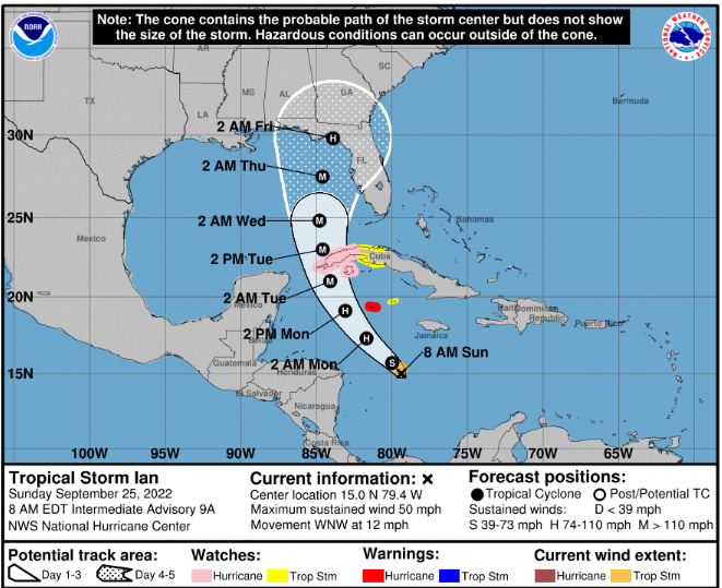
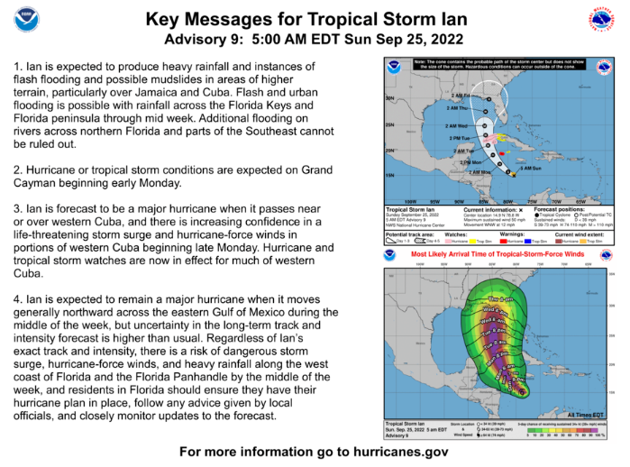
Ian remains a tropical storm this morning with sustained winds of 50 MPH as it moves west northwest at 12 MPH and is around 200 miles southeast of Jamaica. Throughout the day yesterday and this morning models have continued to move Ian’s track to the west, which now has most eventual landfall predictions being from the north of Tampa Bay to all the way across the Florida panhandle. As the NHC notes, there is still a lot of uncertainty in the long term tracks and intensity models. Ian is still disorganized this morning, but models are showing it getting together better through today and tomorrow and starting to quickly strengthen in the very warm waters. Current NHC models are showing Ian being a CAT 3 as it approaches Cuba on Tuesday and as it moves further into the Gulf. As of now models are showing a weakening as it approaches Florida and deals with drier air and increasing shear. Beacon is showing a CAT 1 or tropical storm at landfall and many other models are agreeing with a weaker storm near shore, however hurricane conditions and surge can be expected along the entire east coast of Florida if models hold. As for now there are hurricane warnings in place for Grand Cayman and hurricane watches in place for western Cuba. We’ll need to continue to monitor the models closely throughout the day today. Comments are closed.
|
Archives
May 2024
Categories |
Adjusters |
Company |
|


