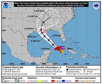
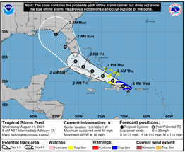
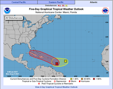
 As of 11:00 am, Hurricane Ida is expected to intensify further now to 120mph before landfall. Pressures are falling and Hurricane Hunters are finding the storm structure is improving. Rapid Intensification is likely tomorrow. Ida is tracking almost the same keeping LA and some of MS in the cone. Landfall later Sunday... with feeder bands reaching parts of the Gulf coast throughout Saturday night into Sunday as it approaches. Adjusters are on standby and mobilization to Louisiana is planned.  Tuesday evening, Fred became a Tropical Storm with sustained winds of 40 MPH. Fred is making it's way over the island of Hispaniola today and if it stays intact over this mountainous island, it could re-strengthen quickly due to the warm water around the Bahamas. Leading Edge Claims will continue to monitor Fred as it makes it's way towards Florida. Stay up to date by following LECS on Facebook and LinkedIn or visiting https://www.nhc.noaa.gov/. Ensure your profile is up to date by going to https://www.leadingedgeclaims.com/employment.html.  Happy Monday Morning! Leading Edge is watching the weather in the Atlantic closely as more activity has begun to develop. Invest 94 (in red) has a 70% chance of development in the next two days and has a good chance of developing into a tropical depression or storm later today or tonight. Invest 93 (in yellow) is showing a more southernly route but only a 20% chance of development at this time. To learn more, check out the National Hurricane Center at https://www.nhc.noaa.gov/! As always, make sure your information is up to date by heading over to our website or emailing hr@leadingedgeclaims.com to ensure there will be no delay in potential future deployments! |
Archives
April 2024
Categories |
Adjusters |
Company |
|
